The Rakaposhi Base Camp Trek is one of the most accessible and visually striking high-altitude treks in the Karakoram Range, Pakistan. Starting from Minapin Village, Nagar Valley, Gilgit-Baltistan, Pakistan, this moderate trail climbs approximately 1,500 metres (4,900 feet) through juniper forests and alpine meadows to the foot of Rakaposhi, the world’s 27th highest mountain at 7,788 metres (25,551 feet). Unlike multi-week expeditions deeper in the Karakoram, this Rakaposhi trek in Pakistan places you directly beneath the ice-draped flanks of a 7,000-metre peak in just two days of hiking. Whether you are researching your first Hunza Valley trek or adding another route to your trekking-in-Gilgit-Baltistan record, this Rakaposhi trekking guide covers the full route, honest difficulty assessment, month-by-month weather, packing essentials, transport logistics, and costs.
Table of Contents
Trek overview: distance, duration, and what makes this route stand out
The Rakaposhi Base Camp Trek covers approximately 12 kilometres one way from Minapin Village, Nagar Valley, Gilgit-Baltistan, Pakistan, at roughly 2,000 metres (6,600 feet) to Rakaposhi Base Camp at approximately 3,500 metres (11,500 feet). The complete 8-day itinerary operated by North Nomads includes two driving days each way along the Karakoram Highway, two days of trekking, and time to explore the Hunza Valley. The trekking portion gains roughly 1,500 metres (4,900 feet) of elevation across two hiking days, split between an intermediate camp at Hapakun and the final push to the Tagaphari meadow and viewpoint ridge at base camp. The route is rated moderate by most operators and is widely considered one of the best treks in Pakistan for those seeking genuine Karakoram trekking without technical climbing requirements. Peak season runs from mid-June through September, with July and August offering the warmest conditions and clearest high-altitude skies.
Rakaposhi Base Camp Trek at a glance
The trek begins at Minapin Village, Nagar Valley, Gilgit-Baltistan, Pakistan, at 2,000 metres (6,600 feet) and finishes at Rakaposhi Base Camp at 3,500 metres (11,500 feet). Day one of hiking covers 5.8 kilometres gaining 800 metres of elevation to Hapakun Camp at 2,800 metres (9,200 feet). Day two covers 3 kilometres gaining a further 500 metres to the Tagaphari viewpoint ridge. Total round-trip trekking distance is approximately 24 kilometres. The full 8-day itinerary spans 620 kilometres of Karakoram Highway driving and two days of trekking each way. The route is rated moderate, requires no technical skills, and is open from mid-June through early October.
The route: day-by-day breakdown
Day 1: Arrival in Islamabad, Pakistan
Your journey begins in Islamabad, Pakistan, elevation 540 metres (1,772 feet). After clearing customs at Islamabad International Airport (ISB), Pakistan, your ground team greets you with a traditional welcome and transfers you by private vehicle to a luxury guest house in the diplomatic enclave. The remainder of the day is dedicated entirely to rest and acclimatisation following your international flight. No sightseeing is scheduled on arrival day. In the evening, gather with your group and trek leader for a pre-trek briefing over dinner at the guest house, where you will review the itinerary, discuss gear, and learn what to expect from the Karakoram Highway drive and the trail ahead.
Day 2: Islamabad to Chilas via the Karakoram Highway
The convoy departs early for Chilas, Gilgit-Baltistan, Pakistan, covering approximately 420 kilometres over 10 to 12 hours. The route follows the Karakoram Highway (N-35), one of the world’s highest paved international roads. The first stretch passes through Abbottabad, Khyber Pakhtunkhwa, Pakistan, before descending into the Indus Valley at Besham, where the landscape transforms dramatically from green hills to rugged mountain desert. The road then follows the mighty Indus River through deep gorges, with the terrain growing increasingly arid and vertical as you push north. Arrive in Chilas at an elevation of roughly 1,250 metres (4,100 feet) by evening and settle into your hotel for the night.
Day 3: Chilas to Karimabad, Hunza Valley, with Eagle’s Nest sunset
The drive from Chilas, Gilgit-Baltistan, Pakistan, to Karimabad, Hunza Valley, Gilgit-Baltistan, Pakistan, covers approximately 200 kilometres and takes four to five hours. The route passes through Gilgit, the regional capital at 1,500 metres (4,900 feet), and continues north along the Hunza River corridor. The famous Rakaposhi Viewpoint on the Karakoram Highway offers your first full-frame view of the mountain’s 7,788-metre summit, a moment that makes the long drive worthwhile. After checking into your hotel in Karimabad at 2,438 metres (8,000 feet), a 20-minute drive up winding roads delivers you to Eagle’s Nest viewpoint at 2,935 metres (9,630 feet) for a spectacular sunset. From this vantage point, the panorama spans Rakaposhi, Lady Finger Peak, Ultar Sar, Golden Peak (Spantik), and the entire Hunza Valley spread below.
Day 4: Hunza Valley exploration and transfer to Minapin Village
The morning begins with a guided tour of Baltit Fort, Karimabad, Hunza Valley, Gilgit-Baltistan, Pakistan, a 700-year-old royal residence with Tibetan-influenced architecture that echoes the design of Lhasa’s Potala Palace. From Baltit, descend through the old town to Altit Fort, the oldest monument in Gilgit-Baltistan at roughly 1,100 years old, perched on dramatic cliffs above the Hunza River. Below the fort, stroll through the peaceful Kha Basi Royal Gardens with their ancient apricot orchards.
After lunch, explore Karimabad’s bazaar for local crafts, dried fruits, and gemstones sourced from the surrounding valleys. In the late afternoon, transfer approximately 20 kilometres to Minapin Village, Nagar Valley, Gilgit-Baltistan, Pakistan, at 2,012 metres (6,600 feet), the trailhead for the Rakaposhi Base Camp Trek. Here you meet your trekking team, porters, and camp crew, and receive a full briefing on the two days of hiking ahead. The evening is free to prepare gear and settle in at the local guest house.
Day 5: Trek from Minapin Village to Hapakun Camp
The Rakaposhi Base Camp hike begins at Diran Guest House in Minapin Village, Nagar Valley, Gilgit-Baltistan, Pakistan. The trail follows an irrigation channel beneath ancient walnut trees before crossing a footbridge over the Minapin River at 2,103 metres (6,900 feet). From the bridge, the path climbs steadily through switchbacks lined with open juniper forest. The gradient is sustained and steep in places, so an early morning start is recommended to avoid the high-altitude sun.
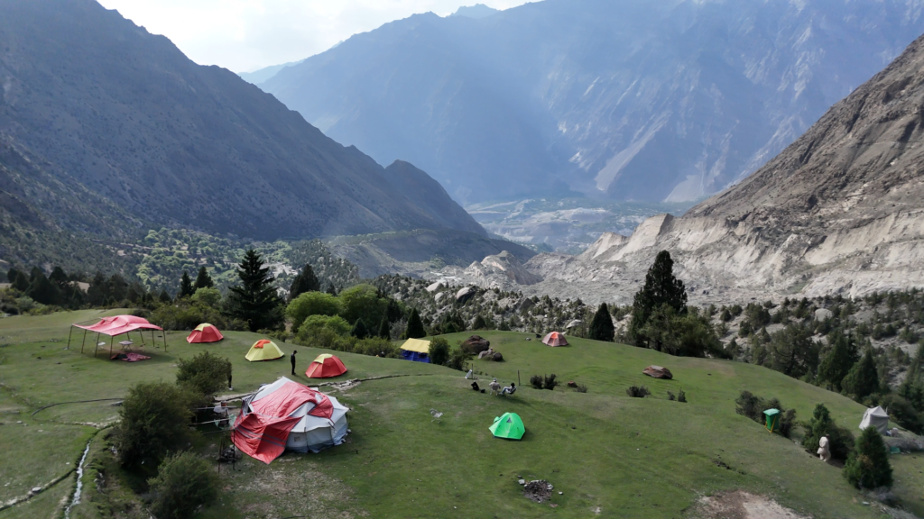
Roughly halfway up, the shepherd settlement of Bang-i-das provides a natural rest stop beside a refreshing stream. The final 90-minute section leads through increasingly dramatic terrain to Hapakun meadow at 2,804 metres (9,200 feet), a beautiful tiered campsite beneath mature fir trees. This first day covers approximately 5.8 kilometres with around 800 metres of elevation gain over three to five hours of walking. Your camp crew will have tents erected and hot tea waiting by the time you arrive, with your first dramatic views of the Rakaposhi and Diran massif opening up above the treeline.
Day 6: Trek to Rakaposhi Base Camp and exploration
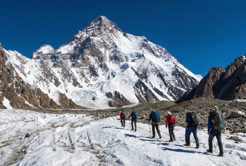
A shorter but steeper day brings you to the heart of the Karakoram. From Hapakun Camp, Nagar Valley, Gilgit-Baltistan, Pakistan, the trail climbs through dusty switchbacks in fir forest before opening into a verdant bowl carpeted with wildflowers during July and August. The path traverses scattered juniper stands and climbs final switchbacks to a windy ridge, where the full Rakaposhi and Diran ice wall comes into view for the first time: a vertical kilometre of hanging glaciers and seracs connecting the two peaks.
A 15-minute traverse above the Minapin Glacier delivers you to Tagaphari meadow, Rakaposhi Base Camp, at 3,261 metres (10,700 feet). This level pasture, with active shepherd camps in summer, offers unobstructed views of Rakaposhi’s north face, Diran Peak at 7,266 metres (23,839 feet), and the vast Minapin Glacier system. The day covers approximately 3 kilometres with 450 metres of elevation gain over two to three hours.
The afternoon is free to explore the ridge systems above camp, photograph the peaks from multiple angles, or simply absorb the immense scale of the mountains. As evening falls, watch alpenglow paint Rakaposhi’s ice walls gold and pink while the sun sets behind you. This is the emotional centrepiece of the Rakaposhi Base Camp Trek: an unobstructed, close-range perspective on one of the Karakoram’s most dramatic mountain walls.
Day 7: Descent from base camp to Minapin Village, transfer to Karimabad
Rise early for sunrise over the peaks. The morning light on Rakaposhi’s ice walls is one of the most memorable moments of the entire trek. After breakfast, begin the descent through now-familiar terrain, appreciating new perspectives on the valley below as you lose elevation. The return to Minapin Village, Nagar Valley, Gilgit-Baltistan, Pakistan, at 2,012 metres (6,600 feet) takes approximately four to five hours, retracing the full 1,250 metres of elevation loss.
Vehicles wait at Minapin to transfer you back to Karimabad, Hunza Valley, Gilgit-Baltistan, Pakistan, at 2,438 metres (8,000 feet), where a hot shower and comfortable bed mark the end of the trekking phase. The evening is free to revisit Eagle’s Nest for a final sunset, explore Karimabad’s cafes, or simply rest and celebrate a successful trek.
Day 8: Upper Hunza day trip, Attabad Lake, Passu, and drive to Chilas
Before beginning the return journey south, the day opens with an exploration of Upper Hunza’s dramatic landscapes. Drive through the tunnels carved after the 2010 landslide to emerge at Attabad Lake, Hunza Valley, Gilgit-Baltistan, Pakistan, where turquoise waters stretch beneath towering peaks. An optional boat ride is available on the lake.
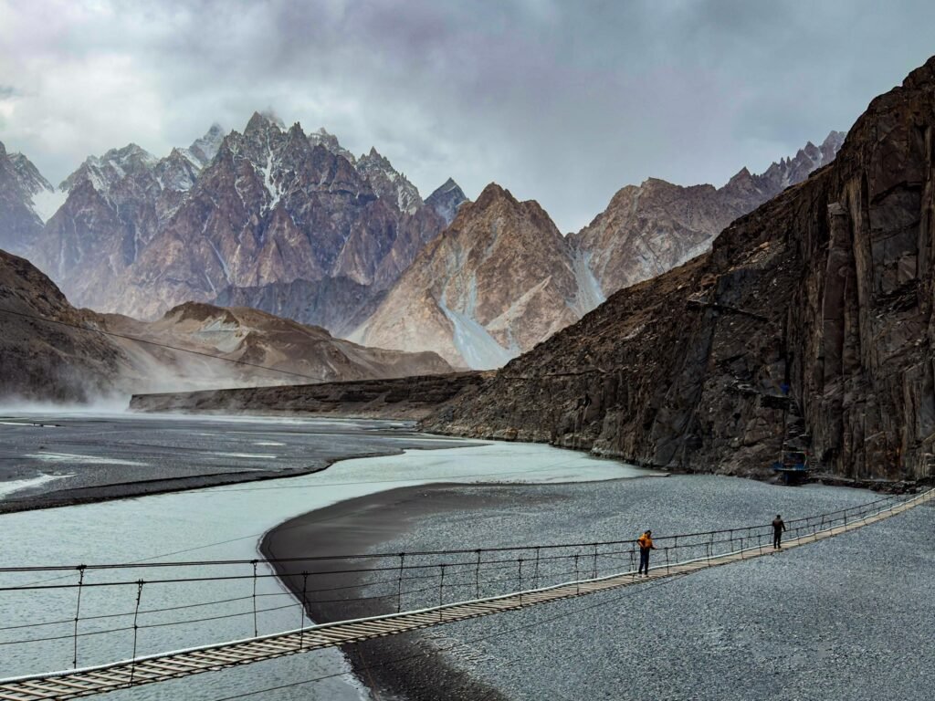
Continue to Passu, Gojal, Gilgit-Baltistan, Pakistan, for views of the cathedral-like Passu Cones (Tupopdan) at 6,106 metres (20,033 feet) and the iconic Passu Glacier descending toward the valley floor. Walk across the Hussaini Suspension Bridge, Gilgit-Baltistan, Pakistan, where rickety wooden planks span the Hunza River with the Passu Cones as a backdrop.
Return through Karimabad for lunch, then begin the scenic drive south along the Karakoram Highway. Pass through Gilgit and follow the Indus River as the sun sets over the mountains. Arrive in Chilas, Gilgit-Baltistan, Pakistan, at 1,250 metres (4,100 feet) for overnight.
Day 9: Chilas to Islamabad, departure or optional extra night with city tour
The final day follows the Karakoram Highway south through the dramatic Indus Gorge, stopping at key viewpoints including the confluence of the Indus and Gilgit rivers. The landscape gradually transforms from barren mountain desert to lush green hills as you approach Besham and continue through Abbottabad, Khyber Pakhtunkhwa, Pakistan. Arrive in Islamabad, Pakistan, at 540 metres (1,772 feet) by evening for transfer to your hotel or the airport.
For those who prefer an extra night to recover from the drive, a complimentary half-day city tour the following morning covers Faisal Mosque, Islamabad, Pakistan, one of the world’s largest mosques; Daman-e-Koh viewpoint in the Margalla Hills, Islamabad, Pakistan, with panoramic views across the capital at roughly 600 metres (2,000 feet); and the Pakistan Monument, Islamabad, Pakistan, a petal-shaped national landmark. The optional extra night provides a relaxed final morning before your flight home.
Rakaposhi Base Camp difficulty and fitness requirements
The Rakaposhi Base Camp hike is rated moderate by most licensed trekking operators in Gilgit-Baltistan, Pakistan. The total elevation gain of approximately 1,500 metres (4,900 feet) is spread across two hiking days, which significantly reduces the strain compared to completing the same route as a single-day push. No technical climbing, ropes, or glacier crossings are required on the standard route. The trail is a well-trodden footpath for its entire length.
That said, the Rakaposhi Base Camp difficulty should not be underestimated. The switchbacks above Minapin Village, Nagar Valley, Gilgit-Baltistan, Pakistan, are steep and sustained, and the final push from Hapakun to Tagaphari is relentless uphill. At 3,500 metres (11,500 feet), altitude effects such as mild headache or shortness of breath are common for visitors arriving from sea level. Two days spent at 2,500 metres in Karimabad, Hunza Valley, Gilgit-Baltistan, Pakistan, before starting the trek provide crucial acclimatisation time.
Fit beginners who hike regularly can complete this route comfortably. The key is preparation: start a cardiovascular training programme at least eight weeks before departure, incorporating uphill walking, stair climbing, or cycling three to four times per week. Leg and core strength exercises will ease the steep descent on Day 6, and trekking poles are strongly recommended. Anyone with respiratory conditions, serious knee problems, or no recent hiking experience should consult a doctor before committing. Experienced trekkers will find this one of the most rewarding introductory routes in the Karakoram, offering genuine high-altitude immersion without the multi-week commitment of routes further east toward K2 and Concordia in Baltistan, Gilgit-Baltistan, Pakistan.
Best time for Rakaposhi Base Camp trek
The trekking season for the Rakaposhi Base Camp Trek runs from mid-June through early October, with conditions varying significantly across those months. Gilgit-Baltistan, Pakistan, sits in the rain shadow of the Himalayan Range, which means it receives far less monsoon rainfall than the rest of Pakistan during summer. Still, each month presents its own profile.
June marks the opening of the season once winter snow clears from the trail above 3,000 metres (9,800 feet). Daytime temperatures at Rakaposhi Base Camp, Nagar Valley, Gilgit-Baltistan, Pakistan, range from 15 to 22 degrees Celsius (59 to 72 degrees Fahrenheit), while nights can drop to 2 to 8 degrees Celsius. Snow patches may linger on the upper ridge in early June, and some years the trail to Tagaphari does not fully clear until the third week of the month.
July and August deliver the warmest conditions, with daytime highs at base camp reaching 18 to 25 degrees Celsius (64 to 77 degrees Fahrenheit) and nights sitting between 5 and 10 degrees Celsius. These are the peak months for Karakoram trekking. Daylight hours are at their longest, the Minapin Glacier is most active, and avalanches on the upper flanks of Rakaposhi provide dramatic visual spectacles from a safe distance at base camp. Occasional afternoon cloud build-up can obscure summit views, so early starts are essential. August sees slightly more precipitation than July, mostly in the form of brief afternoon showers rather than sustained rain.
September is the shoulder-season favourite among experienced trekkers. Temperatures cool to 12 to 18 degrees Celsius during the day, and the crisp autumn air delivers the best visibility of the year. Crowds thin after the summer peak, and the lower valleys of Hunza and Nagar begin to glow with autumn colour. Nighttime temperatures approach freezing, so a warmer sleeping bag becomes necessary.
October is the latest viable month. Daytime highs at base camp fall to 5 to 12 degrees Celsius, and nights regularly dip below zero. Fresh snowfall can close the trail with little warning, and the ridge above Tagaphari becomes exposed to strong wind. Only experienced trekkers with proper cold-weather gear should consider an October attempt.
What to pack for the Rakaposhi Base Camp Trek
Packing for a trek that starts at 2,000 metres (6,600 feet) and climbs to 3,500 metres (11,500 feet) across variable weather demands a layering system built for temperature swings of 25 degrees Celsius or more between midday sun and pre-dawn frost. The following categories cover what you need to bring yourself. Tents, sleeping mats, meals, and cooking equipment are provided by your trekking operator.
Your base layer should be moisture-wicking synthetic or merino wool tops and bottoms. A mid-layer fleece or insulated jacket provides warmth at camp, and a waterproof, windproof shell jacket is essential even in July for afternoon showers and exposed ridge sections above Tagaphari, Nagar Valley, Gilgit-Baltistan, Pakistan. Trekking trousers should be quick-drying and durable; pack a set of thermal leggings for sleeping at Hapakun Camp and Rakaposhi Base Camp.
Footwear matters enormously on the steep, loose terrain above Minapin Village, Nagar Valley, Gilgit-Baltistan, Pakistan. Ankle-supporting, broken-in trekking boots with strong grip are non-negotiable. Bring camp sandals for resting your feet at the end of each hiking day, and pack at least three pairs of merino hiking socks plus liner socks to prevent blisters on the sustained uphill sections.
Gear essentials include trekking poles (telescoping, to pack flat for the Karakoram Highway drive), a headlamp with spare batteries, a 30-to-40-litre daypack, a one-litre water bottle plus purification tablets, and a sleeping bag rated to minus 5 degrees Celsius for September and October treks. A zero-degree-rated bag suffices in July and August. High-SPF sunscreen, UV-blocking sunglasses, and a wide-brimmed hat are critical at altitude where UV intensity increases roughly 10 percent per 1,000 metres of elevation gain.
Personal items include a basic first-aid kit containing blister plasters, altitude-headache medication such as ibuprofen, and rehydration salts. A portable power bank is recommended, as there are no charging facilities between Minapin Village and base camp. Documents to carry include your passport, printed visa confirmation, travel insurance policy covering trekking to 4,000 metres, and printed copies of your booking confirmation.
How to get to Rakaposhi Base Camp
The journey to Rakaposhi Base Camp, Nagar Valley, Gilgit-Baltistan, Pakistan, begins with an international flight into Islamabad International Airport (ISB), Pakistan. Major carriers serving Islamabad include Emirates from Dubai, Qatar Airways from Doha, Turkish Airlines from Istanbul, British Airways from London Gatwick, and Pakistan International Airlines from multiple hubs. There are no direct flights from North America; most Western travellers connect through the Gulf or Istanbul.
From Islamabad, Pakistan, the overland route follows the Karakoram Highway (N-35) approximately 620 kilometres north to Karimabad, Hunza Valley, Gilgit-Baltistan, Pakistan. The drive takes two days with an overnight stop in Chilas, Gilgit-Baltistan, Pakistan, and passes through some of the most dramatic mountain scenery on earth, including the confluence of the Karakoram, Himalayan, and Hindu Kush ranges near Jaglot, Gilgit-Baltistan, Pakistan. A domestic flight from Islamabad to Gilgit, Gilgit-Baltistan, Pakistan, with PIA covers the distance in roughly one hour, but this service is frequently cancelled due to weather and should never be treated as a guaranteed transport plan.
From Karimabad, Minapin Village, Nagar Valley, Gilgit-Baltistan, Pakistan, is a 20-kilometre drive taking approximately 30 minutes. The village sits just off the Karakoram Highway at the base of the Rakaposhi massif, marking the official trailhead for the Rakaposhi Base Camp hike.
Costs and what your Rakaposhi Base Camp Trek includes
North Nomads operates this 9-day Rakaposhi Base Camp and Hunza Valley itinerary on a four-tier group pricing structure in USD, with rates scaling for groups of two, three to four, five to six, and seven or more travellers. Smaller groups pay a higher per-person rate, while groups of seven or more access the most competitive pricing. Current rates are listed on the trip page, and you can contact the team directly for a custom quote.
The package includes airport transfers in Islamabad, Pakistan, all ground transport along the Karakoram Highway, hotel accommodation in Islamabad, Chilas, and Karimabad, all meals during the trek, tent camping at Hapakun and Rakaposhi Base Camp, an experienced local guide and porters from Nagar Valley, Gilgit-Baltistan, Pakistan, the complimentary optional Islamabad city tour on the final day, and all local logistics coordination.
Items not included are international flights, travel and trekking insurance, personal trekking gear, snacks and drinks outside of scheduled meals, tips for guides and porters, and any costs arising from itinerary changes caused by weather or road conditions on the Karakoram Highway. Budget an additional USD 150 to 250 for tips, personal snacks, and souvenirs. Travel insurance covering high-altitude trekking is mandatory for all participants.
Frequently asked questions
Is Rakaposhi Base Camp Trek difficult?
The Rakaposhi Base Camp Trek is rated moderate. The 1,500-metre (4,900-foot) elevation gain is divided across two hiking days, with no technical sections, fixed ropes, or glacier crossings on the standard route. Steep switchbacks above Minapin Village, Nagar Valley, Gilgit-Baltistan, Pakistan, are the most physically demanding section. Fit beginners with a regular exercise routine and some prior hiking experience complete this route comfortably each season.
What is the altitude of Rakaposhi Base Camp?
Rakaposhi Base Camp sits at approximately 3,500 metres (11,500 feet) above sea level in Nagar Valley, Gilgit-Baltistan, Pakistan. The base camp area comprises the Tagaphari alpine meadow and an upper viewpoint ridge, both at roughly the same elevation. This Rakaposhi Base Camp altitude is below the threshold where serious altitude sickness typically occurs, though mild symptoms such as headache and shortness of breath are possible for those arriving directly from sea level without acclimatisation.
How many days is the Rakaposhi Base Camp Trek?
The full itinerary is eight days from Islamabad arrival to Islamabad departure. This includes two days driving each way along the Karakoram Highway, two days of ascending trekking (Minapin Village to Hapakun Camp, then Hapakun to base camp), one descent and Hunza Valley exploration day, and arrival and departure days in Islamabad, Pakistan. The actual trekking portion requires two days ascending and one day descending.
Do I need a permit for Rakaposhi Base Camp?
No special trekking permit is required. Rakaposhi Base Camp, Nagar Valley, Gilgit-Baltistan, Pakistan, falls within an open trekking zone as designated by the Gilgit-Baltistan government. A standard Pakistan tourist visa is sufficient. As of September 2024, the visa process has been significantly simplified: the Pakistan tourist visa is now free of charge, requires no Letter of Invitation, and is typically issued within hours of applying online. The visa is valid for 90 days with multiple entry, giving you flexibility to plan side trips or extend your stay. A small local trail entry fee of approximately PKR 300 (under USD 2) may be collected at Minapin Village, Nagar Valley, Gilgit-Baltistan, Pakistan. Registration with local authorities in Gilgit-Baltistan is recommended for all foreign trekkers.
Can beginners do the Rakaposhi Base Camp Trek?
Yes, fit beginners can complete this trek. It is widely regarded as one of the best introductory high-altitude treks in Pakistan and the Karakoram Range. The key qualifications are a basic cardiovascular fitness level, comfort with walking uphill for three to five hours at a time, and a willingness to camp at altitude. Prior multi-day trekking experience is helpful but not essential. The two-day ascending format through Hapakun Camp, Nagar Valley, Gilgit-Baltistan, Pakistan, allows your body to adjust gradually to the rising elevation.
What is the best month to trek Rakaposhi?
July is the single best month for most trekkers, offering the warmest base camp temperatures at 18 to 25 degrees Celsius daytime, fully cleared trails, and the longest daylight hours. September is the top choice for those who prioritise visibility and solitude, with cooler temperatures but crystal-clear conditions across the Karakoram Range, Pakistan. June and August are also excellent months, while October is viable only for experienced, cold-weather-equipped trekkers.
Why Rakaposhi Base Camp deserves a place on your trekking calendar
Few treks in the Karakoram Range deliver this ratio of effort to reward. In two days of moderate hiking from Minapin Village, Nagar Valley, Gilgit-Baltistan, Pakistan, you stand at 3,500 metres (11,500 feet) looking directly into the ice-armoured face of a 7,788-metre giant while the Minapin Glacier carves its path below your feet. The Rakaposhi Base Camp Trek combines the cultural richness of the Hunza Valley, the engineering spectacle of the Karakoram Highway, and the raw alpine scale of Gilgit-Baltistan, Pakistan, into a single week-long journey. It asks for a reasonable level of fitness, a genuine curiosity about high mountain landscapes, and eight days of your time. What it returns is a perspective on the Karakoram that stays with you long after you leave the trail. Explore the full trip details and book your dates on the Rakaposhi Base Camp and Hunza Valley trip page.
-
Guaranteed Group Discount Available Available PackagesSaturdayAugust 8, 2026SundayAugust 16, 2026$99512Available
-
Guaranteed Group Discount Available Available PackagesSaturdayAugust 15, 2026SundayAugust 23, 2026$99512Available
-
Guaranteed Group Discount Available Available PackagesSaturdayAugust 22, 2026SundayAugust 30, 2026$99512Available
-
Guaranteed Group Discount Available Available PackagesSaturdayAugust 29, 2026SundaySeptember 6, 2026$99512Available
-
Guaranteed Group Discount Available Available PackagesSaturdaySeptember 5, 2026SundaySeptember 13, 2026$99512Available